A surface can look perfect and still be wrong.
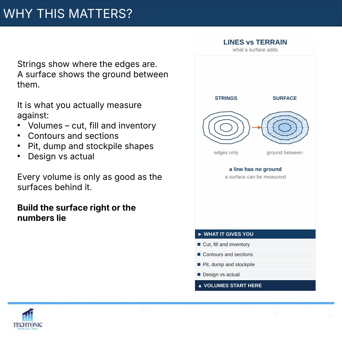
Strings show where the edges are. A surface shows the ground between them, and it is what you actually measure against: cut, fill and inventory volumes, contours and sections, pit, dump and stockpile shapes, design against actual. Every volume you report is only as good as the surface behind it — and a bad surface still gives you a number.
What a surface is
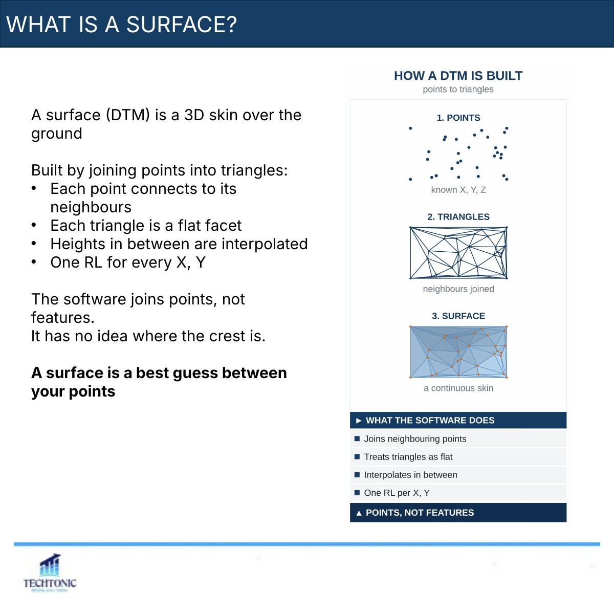
A surface, or DTM, is a 3D skin over the ground, built by joining points into triangles. Each point connects to its neighbours, each triangle is a flat facet, and heights in between are interpolated, giving one RL for every X and Y.
The key thing to understand: the software joins points, not features. It has no idea where your crest is unless you tell it. A surface is a best guess between your points.
Inputs: points and strings
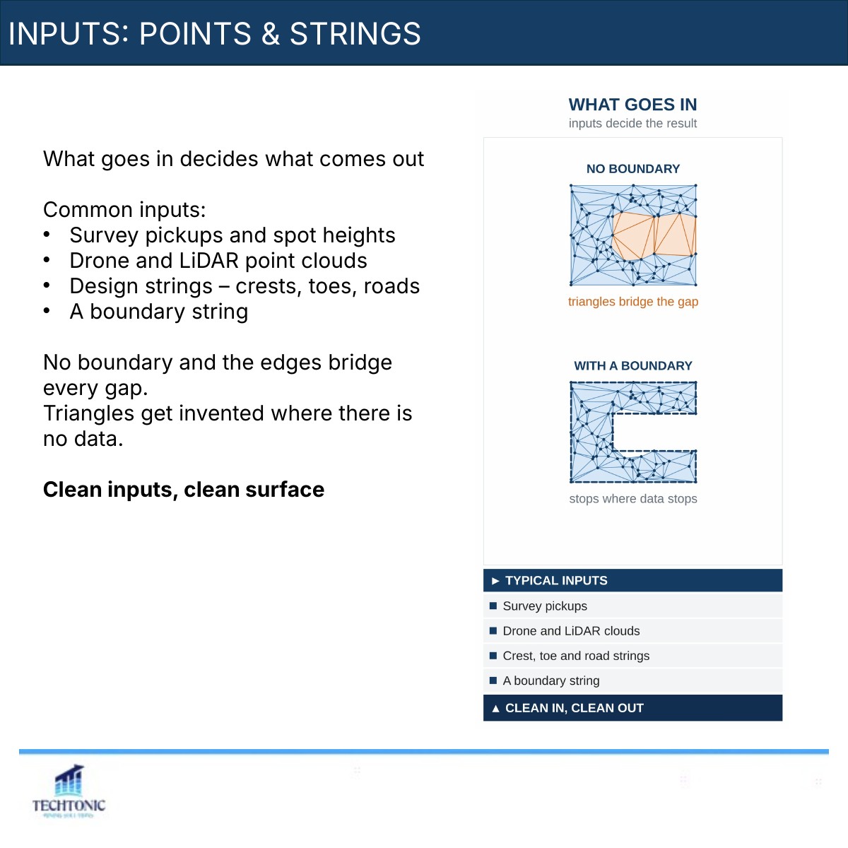
What goes in decides what comes out. Common inputs are survey pickups and spot heights, drone and LiDAR point clouds, design strings such as crests, toes and roads, and a boundary string.
Leave out the boundary and the edges bridge every gap, with triangles invented where there is no data. Clean inputs, clean surface.
Breaklines matter
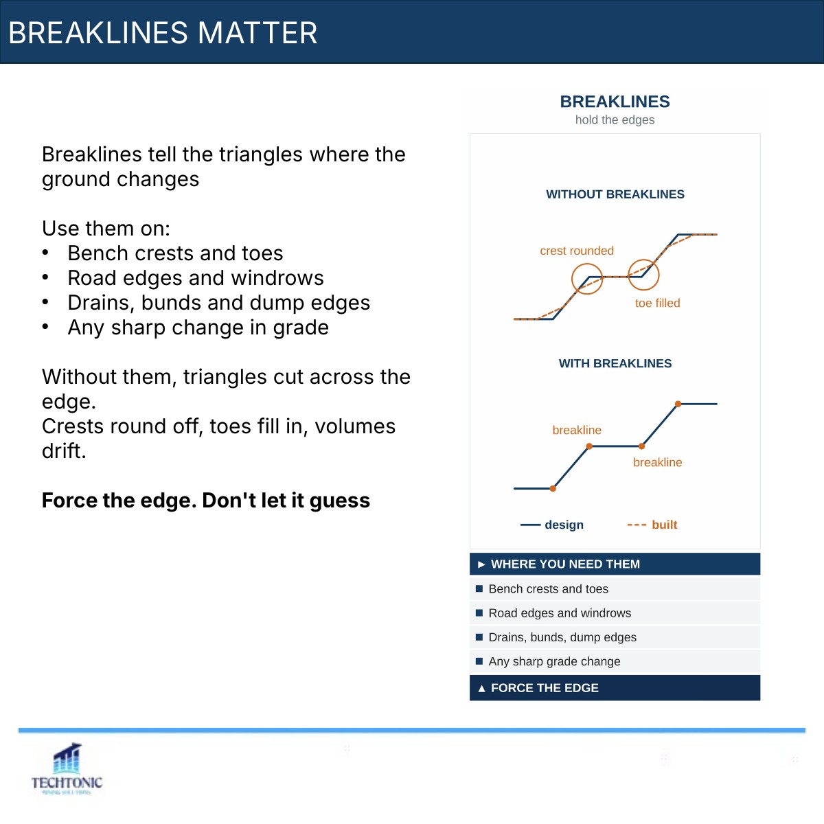
Breaklines tell the triangles where the ground changes. Use them on bench crests and toes, road edges and windrows, drains, bunds and dump edges, and anywhere there is a sharp change in grade.
Without them, triangles cut across the edge. Crests round off, toes fill in, and volumes drift. Force the edge — do not let the software guess.
The surface we have all inherited
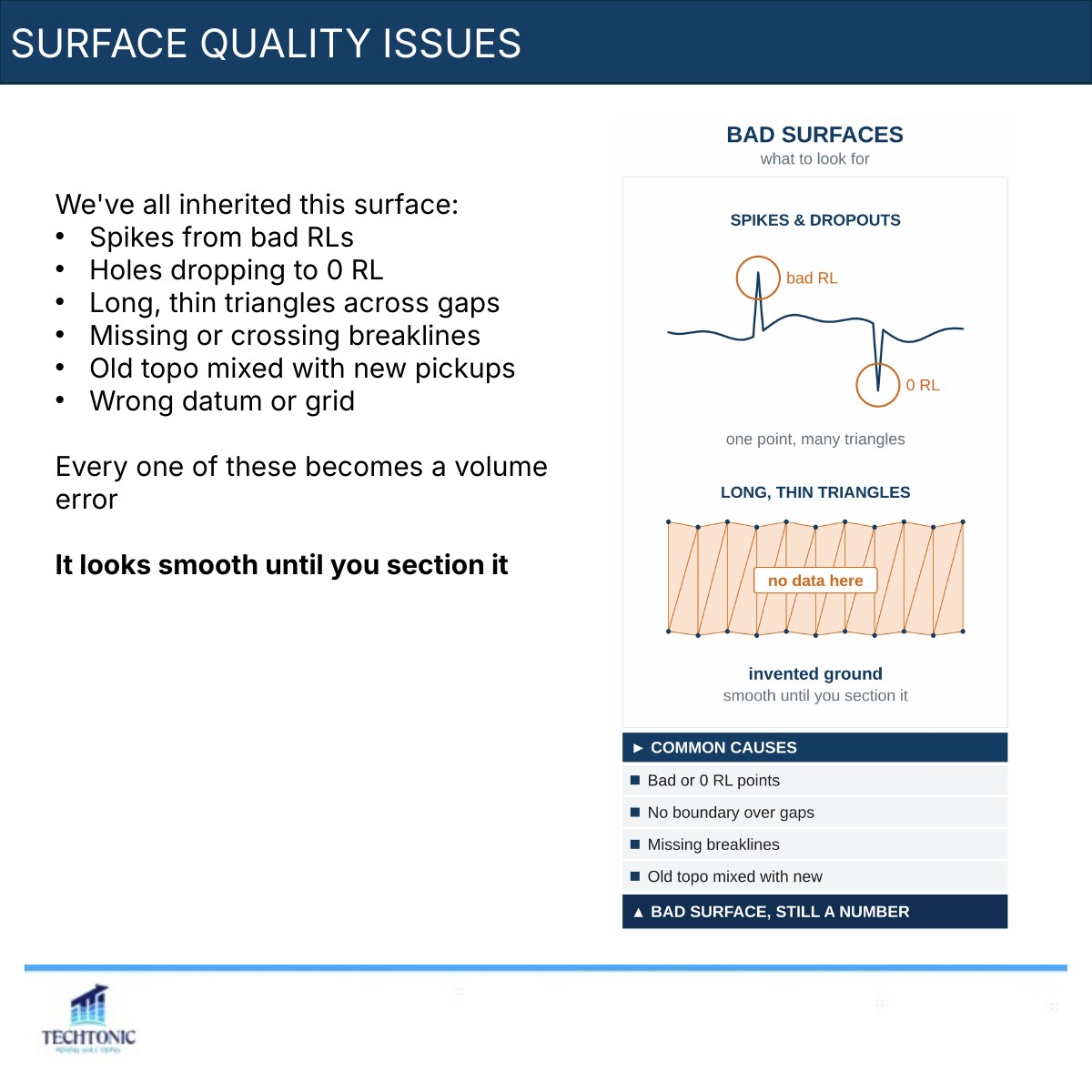
- Spikes from bad RLs
- Holes dropping to 0 RL
- Long, thin triangles across gaps
- Missing or crossing breaklines
- Old topo mixed with new pickups
- The wrong datum or grid
Every one of these becomes a volume error, and the surface looks smooth until you section it.
Check it before you use it
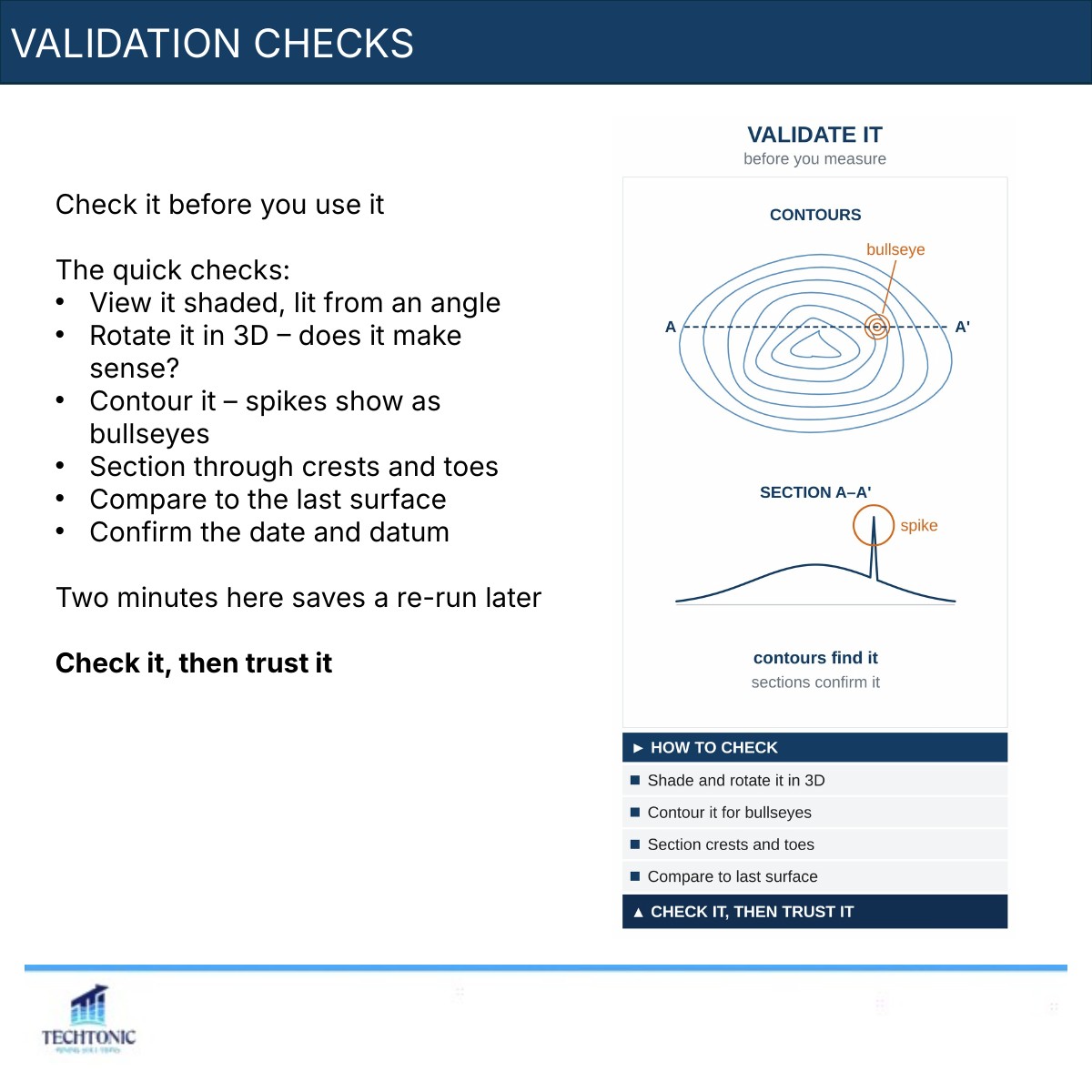
View it shaded, lit from an angle. Rotate it in 3D and ask whether it makes sense. Contour it — spikes show up as bullseyes. Section through the crests and toes. Compare it to the last surface, and confirm the date and datum. Two minutes here saves a re-run later.
Key takeaways
- A surface is points joined into triangles
- Inputs decide the result
- Breaklines hold crests and toes
- Boundaries stop invented ground
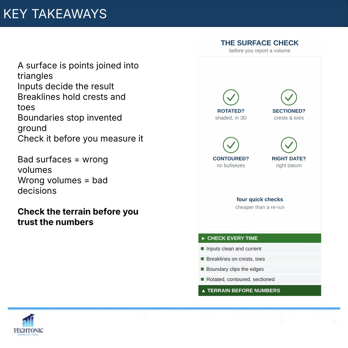
- Check it before you measure it
Bad surfaces mean wrong volumes, and wrong volumes mean bad decisions. Check the terrain before you trust the numbers.
Next in Mine Design 101: volumes and interrogation, turning surfaces into numbers. What is the first thing you check on a surface someone hands you?
The carousel
This piece began as a LinkedIn carousel. The full deck is below — use the arrows, or click any slide to enlarge.